

SKYHOVERA MULTIROTOR UAS PLATFORM FOR
LONG-DURATION OBSERVATION
AND INSPECTION MISSIONS.
Developed for missions that call for hovering, mobility
and a configuration matched to the task.
PLATFORM CAPABILITIES
SkyHover — technical specifications
Flight time, mass and range at a glance. Expand the specifications to compare flight performance, payload options and the power system.
up to 70 min
Maximum flight time
up to 4 kg
Maximum take-off mass (MTOM)
up to 52 km
Maximum flight distance
up to 25 km
Maximum transmission range
Data from the SkyMav specification. Performance depends on configuration, payload and flight conditions; maximum values are not necessarily achieved simultaneously.
Aircraft
Aircraft type
Electric multirotor UAS
MTOM
Up to 4 kg
UAS class — manufacturer declaration
C2
Base payload
Mission camera included
Additional payload
Up to 1 kg
Ingress protection
IP53
Maximum flight time
70 min
Maximum flight distance
52 km
Maximum transmission range
25 km
Flight performance
Maximum horizontal airspeed
18 m/s
Maximum ascent speed
8 m/s
Maximum descent speed
6 m/s
Maximum wind resistance - flight
15 m/s
Maximum wind resistance - take-off and landing
15 m/s
Mission modes
Automatic / Manual
Waypoint mission planning
Supported
Live telemetry
Supported
Live video transmission
Supported
Skydroid C12 — RGB + thermal
Visible camera
5 MP
Video
2560 x 1440 @ 25 fps
Digital zoom
30x
Thermal sensor
384 x 288, up to 25 Hz
Stabilization
3-axis gimbal
Weight
117 g
SIYI A8 Mini — 4K RGB
Image sensor
1/1.7 in Sony CMOS
Resolution
8 MP
Video
4K 3840 x 2160 @ 25 fps
Digital zoom
6x
Stabilization
3-axis gimbal
Weight
95 g
Power system
Configuration
6S
Nominal voltage
22.2 V
Capacity
22,000 mAh / 22 Ah
Nominal energy
488.4 Wh
Camera options are selected for the mission. Other cameras and sensors can also be integrated.
Mission and data capabilities
Mission execution
Automatic flight along planned routes and inspection points, under operator supervision.
Manual control
The operator can fly manually or take over control when required.
Live monitoring
Position, flight parameters, battery status, mission progress and camera feed.
Post-mission data
Data can be made available for review and further processing within 5 minutes after mission completion.
Modular payload
A camera or sensor selected for the task without changing the aircraft platform.
Post-mission data availability does not mean a finished report or an automatic diagnosis. The application and automated reporting remain in development.
PROTOTYPE 2 TEST RESULTS
Results from the endurance trials
Prototype 2 was assessed at TRL 6 in the milestone report dated 30 August 2026. The trials used a single configuration with a thermal imaging camera.
TRL 6
assessment of the specified Prototype 2
6
documented endurance trials
5 of 6
trials exceeded 70 minutes
77.7 min
average across three flights at 6 m/s
Test scope: These results apply to the specified configuration and test conditions. They are not a guaranteed flight-time specification for every mission.
DEVELOPMENT DIRECTION
Our vision
We are developing SkyHover to connect mission planning, data collection and analysis in one inspection workflow. Our aim is to help teams move from observations to decisions with fewer manual steps.
What
We are developing SkyHover towards a fully autonomous inspection platform that carries out missions, gathers data and turns it into useful information.
For whom
For infrastructure operators and inspection teams across energy, rail, industry and other large-area assets.
Goal
Our goal is to make the end-to-end inspection process up to 10× faster than traditional methods. This is a development goal, not a verified result for every mission.
THE SKYHOVER PLATFORM
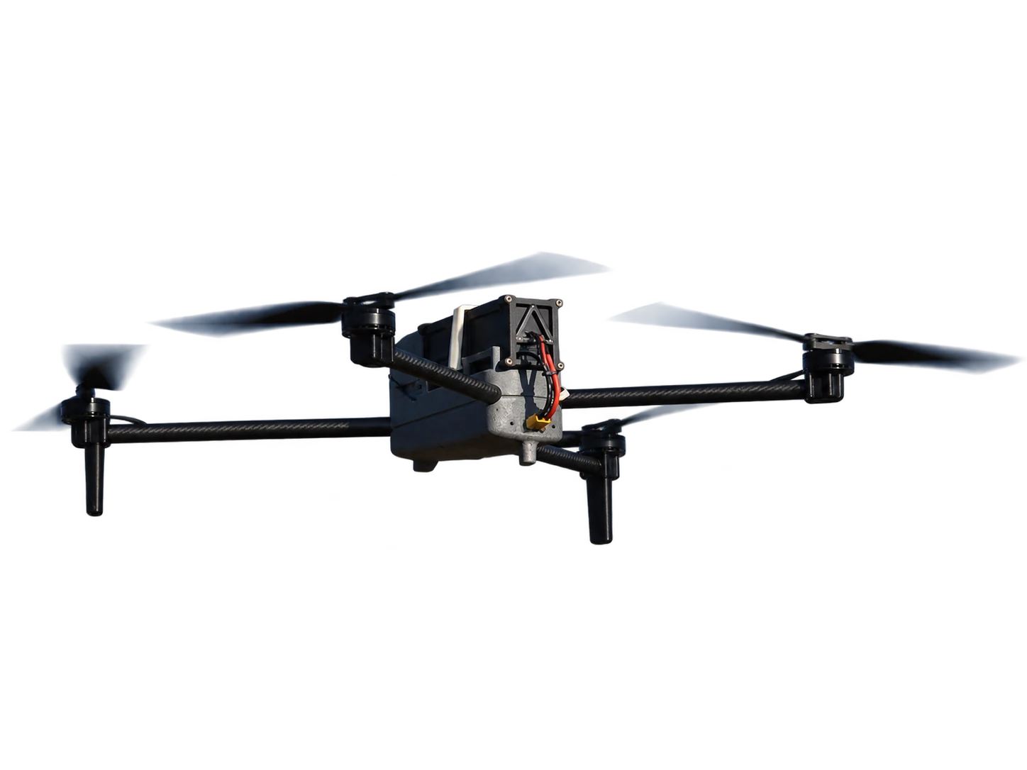
SkyHover up close
SkyHover's multirotor design combines hovering with mobile field operations.
We configure the platform for the specific task, environment and data required.
MISSION WORKFLOW
Why a longer operating window matters
When a mission is split across several flights, it involves repeated landings, servicing and take-offs. A longer operating window may reduce some of these interruptions.
flight
landing
servicing
A mission with several flights
CYCLE 01
SERVICING BREAK
CYCLE 02

take-off

first mission segment

landing

battery servicing

next take-off
mission continues
landing
A mission with a longer flight
take-off
longer mission segment
landing
SKYHOVER IN PRACTICE
The platform in practice
A pilot trial lets you assess SkyHover for your task. Before the flight, we agree what to observe, which data to collect and how to evaluate the trial.
An existing platform
SkyHover is a platform being developed by SkyMav.
Developed in Poland
The SkyMav team leads the platform's development.
Configuration assessed for the task
We agree the payload and conditions before the trial.
POTENTIAL APPLICATIONS
Potential applications
Six areas to discuss a possible SkyHover trial. We assess the scope and platform fit separately for each task.
01
Solar installations
A trial with RGB or thermal imagery: can the material identify areas for further verification? No guarantee of precise temperature measurement.
02
Power lines and transmission assets
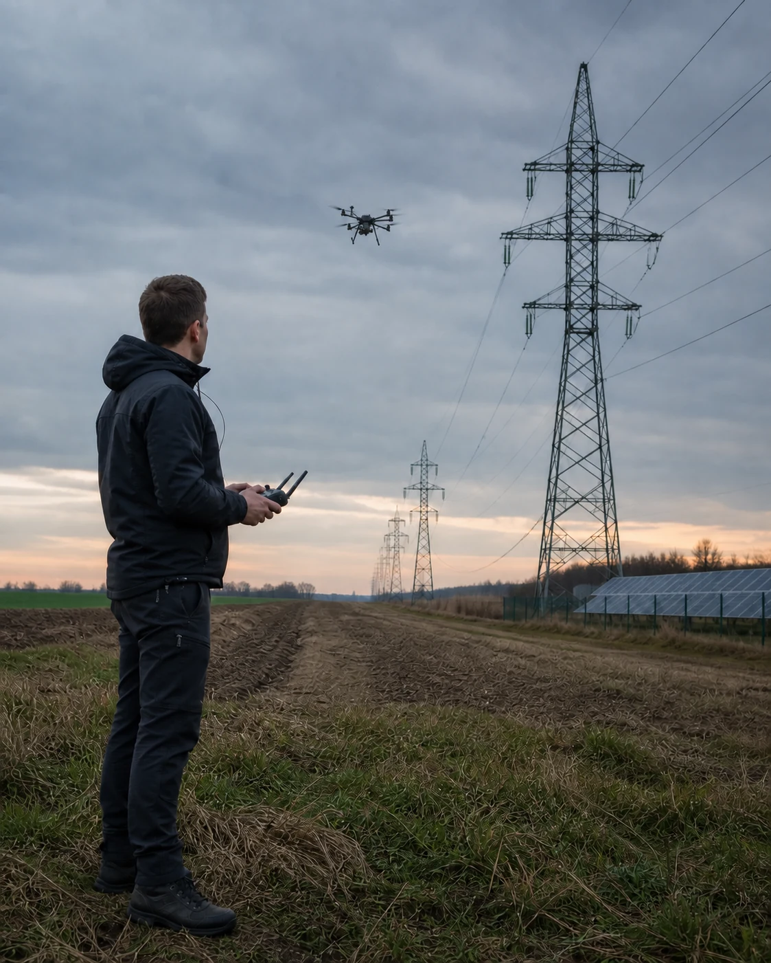
A trial observing a line, pylon or substation from selected points. We assess whether the imagery is sufficient for the agreed evaluation.
03
District heating and gas networks
RGB imagery or thermal screening of selected sections could be the focus of a trial. We agree how to observe the site and assess the material before the flight.
04
Water infrastructure
A trial observing a reservoir, canal or embankment. We assess whether material from selected points answers the questions of the team responsible for the asset.
05
Military applications
Observation of a specified area requires a separate assessment of the objective, permissions, access, responsibilities and permitted data collection.
06
Search and rescue
A trial involving area observation or reconnaissance support requires a separate assessment with the rescue team. We agree the platform's role and how to assess the data before the flight.
DISCUSSION, TRIAL, POSSIBLE NEXT STAGE
How we start
Tell us what you want to assess. You do not need a finished plan — we will agree the route, trial conditions and evaluation criteria together.

around 30 minutes
Discuss the mission
Objective, asset, data, conditions and evaluation criteria.

usually 1 day in the field
Agreed pilot trial
A trial in the confirmed configuration and conditions.

scope agreed individually
Possible next stage
Following the trial assessment and a separate agreement on scope, responsibilities and terms.
CONTACT
Discuss your mission
Tell us what you need. We'll discuss whether a SkyHover pilot trial or support for your UAS project could be the next step. Do not send confidential information.
Do not include confidential information or restricted technical parameters. At this stage, the objective and mission context are enough.
SkyMav develops the SkyHover platform and works on UAS projects within a scope defined after a review.
© SkyMav · 2026
KRS 0001236707 · NIP 7963046809 · REGON 544552882
Małęczyńska 25, 26-600 Radom, Poland

